
Best Boating GPS Units and Chartplotters Products online Canada
Explore our real-time updated product directory index curated for performance, verified star metrics, and historical consumer trust rankings.
Verified Deal Selections
59 Items Indexed


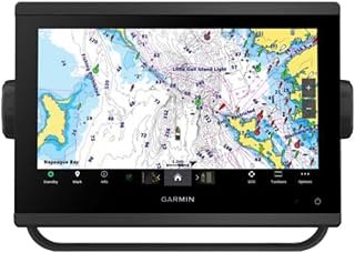


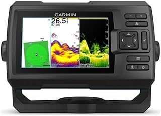


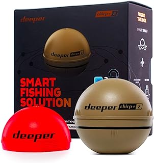


Shop Boating GPS Units and Chartplotters for Canadian Waters
Boating GPS units and chartplotters combine positioning information with marine chart data to support navigation on lakes, rivers and coastal waters. For Canadian boaters, these devices can be useful when travelling unfamiliar routes, planning a fishing trip, monitoring a course or keeping important navigation information visible at the helm. This category brings together marine navigation equipment intended for boat owners who want dedicated electronic guidance rather than relying entirely on a phone or general-purpose navigation device.
When choosing a chartplotter, start by considering how and where you normally use your boat. A compact vessel used on smaller lakes may have different requirements from a larger boat used for coastal cruising. Screen size, chart compatibility, GPS performance, mounting options, connectivity and interface design can all affect how convenient a unit is during a trip. Thinking about your boat and typical routes first can make it easier to narrow down the available options.
What Is a Marine Chartplotter?
A marine chartplotter is an electronic navigation display that uses positioning information and compatible marine charts to show a vessel's location and surrounding navigational information. Depending on the model, a chartplotter may provide route planning, waypoint management, track recording, depth-related information, alarms and integration with other marine electronics. GPS functionality provides positioning data, while chart information gives that position useful geographical and navigational context.
Key Features to Compare
Screen size is one of the most noticeable differences between marine GPS units. A larger display can make charts and navigation information easier to view from a distance, while a compact model can be practical where helm space is limited. Touchscreen controls may provide an intuitive interface, whereas physical buttons or dedicated controls can be useful when operating equipment in changing weather conditions.
Chart support is another important consideration. Check which mapping formats and coverage are compatible with the specific unit before purchasing. Canadian boating routes can range from inland lakes to extensive coastal areas, so the required chart coverage depends on where you plan to navigate. It is also worth checking whether charts are included, preloaded, downloadable or sold separately.
GPS, Connectivity and Marine Electronics
Many modern marine navigation systems can connect with other equipment or devices. Depending on the model, connectivity may support communication with compatible sonar, radar, autopilot, depth or vessel-monitoring equipment. Wireless functionality can also provide convenient data sharing or device integration. If you already have marine electronics installed, check compatibility and connection requirements before selecting a new chartplotter.
Choosing the Right Boating GPS for Your Needs
Consider the size of your boat, available mounting space, preferred viewing distance and the type of waterways you regularly visit. A straightforward GPS display may be sufficient for boaters who primarily need reliable position information, while a more advanced chartplotter may suit users who want route planning and integration with additional marine equipment. Portable units can offer flexibility, while fixed-mounted displays may provide a more permanent helm setup.
Canadian conditions also make practical installation considerations important. Marine electronics should be positioned where the display is easy to see without unnecessarily obstructing the operator's view. Before buying, review the product's mounting method, power requirements, environmental specifications and compatibility with your boat's existing electrical system. Always follow the manufacturer's installation and operating instructions.
Marine Navigation for Fishing and Recreation
Boating GPS units can be useful beyond basic navigation. Anglers may use waypoint features to save productive locations, while recreational boaters can record routes and plan repeat journeys. Families and leisure boaters may also appreciate clear mapping and straightforward controls when exploring unfamiliar areas. The most suitable feature set depends on whether your priority is simple positioning, detailed chart navigation, fishing support or broader marine-electronics integration.
Shop Marine GPS Units and Chartplotters Online
When comparing boating GPS units and chartplotters, focus on the features that match your boat and navigation habits rather than selecting equipment based only on display size or the number of functions. Review chart coverage, screen specifications, installation requirements, connectivity and compatibility carefully. A well-matched marine navigation system can provide useful information at the helm and help you organise routes more confidently across Canada's diverse waterways.
Introduction
Find boating GPS units and chartplotters designed to make marine navigation easier to understand and manage. Whether you are preparing for coastal cruising, fishing trips, recreational boating or longer journeys on Canadian waterways, a suitable marine navigation display can help you monitor your position, plan routes and view useful chart information from the helm.
Frequently Asked Questions
What is the difference between a boating GPS and a chartplotter?
A boating GPS primarily provides positioning information, while a chartplotter combines positioning with compatible marine chart data and navigation functions. Many modern marine devices combine both capabilities in one unit.
What should I look for in a marine chartplotter in Canada?
Consider compatible Canadian chart coverage, screen size, display visibility, GPS performance, mounting requirements, power needs, connectivity and compatibility with your existing marine electronics.
Are marine charts included with every chartplotter?
No. Chart availability varies by product. Some units may include mapping or chart data, while others may require compatible charts to be purchased or downloaded separately. Check the individual product specifications before buying.
Can a chartplotter be used for fishing?
Yes. Depending on the model, chartplotters can support fishing-related navigation by allowing users to save waypoints, plan routes and return to recorded locations. Some systems can also integrate with compatible sonar and other marine equipment.
How do I choose the right screen size for my boat?
Consider the available helm space, viewing distance and how much navigation information you want visible at once. A larger display may improve chart readability, while a compact unit can suit smaller boats or space-constrained installations.
Can a marine GPS connect to other boat electronics?
Some models support connectivity with compatible marine electronics such as sonar, radar, autopilot or vessel-monitoring equipment. Always verify the supported connections and compatibility of the specific devices before installation.
Are boating GPS units suitable for Canadian lakes and coastal waters?
They can be suitable for both inland and coastal boating when the device has appropriate compatible chart coverage and specifications for the intended environment. Check the mapping coverage and product requirements for your planned waterways.
Frequently Asked Questions (FAQ)
❓ How are these Boating GPS Units and Chartplotters options ranked?
Our custom data engine continuously scans product entries to verify high-performing items that carry a consistent rating above 4.2 stars, filtering out unreliable listings or items with artificial review jumps.
❓ Does clicking outbound links increase my checkout price?
Absolutely not. All generated product buttons use standard, secure commercial tracking tags. The item cost values reflect the official live marketplace catalog pricing identically.
❓ How often are the pricing deals updated on this page?
Our data tables utilize automated cache transients refreshed continuously throughout the week to fetch the freshest inventory nodes, live pricing metrics, and tracking structures.
❓ Are these products backed by standard consumer warranties?
Yes. Because our directory routes you directly to the verified official listing pages on Amazon, your purchases qualify for complete merchant protections, returns, and original brand manufacturing warranties.