

♥ Wishlist
Compare 59 Boating GPS Units and Chartplotters products in Canada. Reviews, ratings, pros, cons and buying advice updated for October 2026.


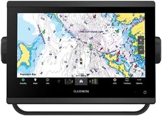


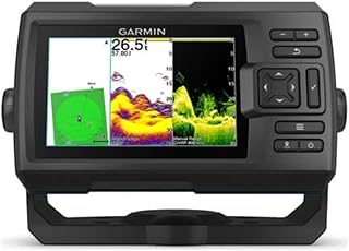
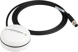


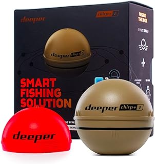


A marine GPS unit and a chartplotter can look similar at first glance, but they are not necessarily interchangeable. A basic GPS can provide position, speed, heading and navigation information, while a modern chartplotter can combine electronic charts with sonar, depth data, radar, AIS, autopilot and other onboard systems. For Canadian boaters, the right choice depends heavily on the type of water you navigate, the size of your vessel, your existing electronics and the amount of navigation information you actually need on the helm.
When comparing boating GPS units and chartplotters in Canada, avoid choosing solely on screen size or advertised feature count. A well-matched system with clear charts, dependable positioning, suitable transducer support and an interface you can operate confidently may be more useful than a much larger unit filled with functions you rarely use.
A marine GPS receiver determines your location using satellite positioning. A chartplotter takes that position information and displays it against digital nautical charts, allowing you to plan routes, mark waypoints, follow tracks and monitor your position relative to hazards or navigation features.
Many current marine displays combine both functions, which is why the terms GPS, marine GPS, GPS chartplotter, multifunction display and MFD are often used together in buying searches.
A dedicated marine GPS may concentrate on position, navigation data and waypoint management. This can be useful for boaters who want straightforward navigation without investing in a larger multifunction system.
A chartplotter adds digital chart information to the positioning system. Depending on the model, it may support route planning, track recording, depth overlays, weather information, sonar integration and other navigation features.
An MFD is designed to act as the central display for multiple marine systems. Depending on compatibility and configuration, an MFD from brands such as Garmin, Lowrance, Simrad, Raymarine or Humminbird may integrate navigation, sonar, radar, AIS, engine information, autopilot and networking functions.
The important distinction for shoppers is that not every screen supports every accessory. Always check the exact model's input, output, networking and transducer compatibility before buying.
An independent buying guide should assess a marine navigation display according to how well its specifications match real boating requirements rather than simply ranking the most expensive equipment highest.
Position accuracy is fundamental to marine navigation. Look for a unit that clearly states its supported positioning technologies and understand that practical accuracy can vary according to satellite visibility, antenna placement, atmospheric conditions and other environmental factors.
For larger boats or installations where positioning consistency is particularly important, examine whether the system supports an external GPS antenna and whether that antenna can be positioned in an appropriate location with a clear view of the sky.
Chart coverage deserves special attention in Canada because boating environments range from inland lakes and rivers to the Great Lakes, Atlantic coast, Pacific coast and northern waters. A chartplotter that works well for one region may not include the same level of chart coverage required for another.
Before purchasing, identify the specific waters you regularly navigate and verify the chart coverage for those areas. Do not assume that a chartplotter automatically includes every Canadian waterway simply because it is marketed as a marine GPS.
A larger screen makes charts and navigation information easier to see, particularly when several data panels are displayed simultaneously. However, bigger is not always better for a compact helm.
Measure the available mounting area before selecting a display. Also consider the distance between the operator and the screen. A compact display can be perfectly practical on a small fishing boat, while a larger centre-console, cruiser or offshore vessel may benefit from substantially more screen real estate.
Marine displays must remain readable in bright outdoor conditions. Look beyond resolution and examine the manufacturer's information about brightness, optical bonding and sunlight visibility where available.
Touchscreen operation can be convenient, but physical controls, rotary controllers or dedicated buttons can be valuable when the display is wet or when the boat is moving in rough conditions. Some systems combine touchscreen functionality with physical controls for this reason.
A touchscreen provides an intuitive interface for panning charts, selecting menu items and entering information. Physical controls can make common operations easier when wearing gloves, dealing with spray or operating the boat in less-than-ideal conditions.
Neither approach is automatically superior. Consider your boating environment, the type of vessel, how exposed the helm is and whether you expect to use the chartplotter while underway in challenging conditions.
Electronic charts are one of the most important parts of a marine navigation system. The display itself may be excellent, but its usefulness depends on the charts available for your operating area.
Raster charts resemble digital images of traditional charts. Vector charts are database-driven and can provide interactive information that changes according to zoom level and user settings.
Many modern systems emphasize vector charting because it can support interactive layers, points of interest, navigation aids and additional information. However, the exact chart presentation and available detail depend on the chart source and coverage.
Chart data can change over time. Navigation information, aids, depths and other charted details may be revised, so buyers should determine how chart updates are handled before choosing a system.
Some chartplotters rely on separately purchased chart cards, while others support downloadable or subscription-based chart services. Check the current terms associated with the exact product and chart package rather than assuming that all updates are included indefinitely.
Canadian boaters should think geographically before buying. A user navigating a small inland lake has different chart requirements from someone crossing portions of Lake Ontario, operating around British Columbia's coastline or travelling along the Atlantic coast.
Make a list of your primary boating locations and compare the chart coverage against those locations. If you regularly travel between provinces or into U.S. waters, verify cross-border coverage as well.
For anglers, combining navigation and sonar can be more practical than installing separate displays. A multifunction display may provide chart navigation, GPS positioning, traditional sonar and advanced fish-finding technologies from a single helm location.
Brands such as Lowrance, Garmin and Humminbird offer marine electronics designed around fishing and navigation ecosystems, while other manufacturers place greater emphasis on cruising, sailing, offshore navigation or integrated vessel systems.
Traditional sonar can help identify depth, bottom contours and underwater targets. Its usefulness depends on transducer selection, installation quality, water conditions, boat speed and the specific sonar technology supported by the system.
Imaging technologies can provide more detailed representations of underwater structures and objects. These capabilities are particularly attractive to anglers who want to study structure, drop-offs, vegetation and other underwater features.
Do not select a display based solely on a sonar feature name. Verify that the required transducer is compatible with the exact display and determine whether that transducer is included or purchased separately.
For boaters who want a system that can expand over time, integration is an important buying consideration.
Radar can provide additional situational awareness by detecting objects and targets that may not be visible from the helm. Depending on the system, radar information can be overlaid on electronic charts.
If radar is part of your future plan, confirm that the chartplotter is compatible with the radar hardware you intend to use. Compatibility is often ecosystem-specific, so choosing a display first and researching radar later can unnecessarily restrict your options.
Automatic Identification System information can provide data about suitably equipped vessels, including identity and movement information. An AIS-capable setup can be useful for situational awareness, but AIS should not be treated as a replacement for visual observation, radar or prudent navigation practices.
An integrated chartplotter can make route information available to compatible autopilot systems. However, autopilot integration involves more than simply buying a display. Compatibility, steering-system requirements, sensors, networking and installation all need to be considered.
Connectivity can make a major difference when building a modern marine electronics system. Before buying, identify which equipment you already own and which components you might add later.
NMEA 2000 is widely used for exchanging information between compatible marine electronics. Depending on the installation, data such as GPS position, heading, depth, engine information and other parameters can be shared across a network.
Do not assume that two products can communicate simply because both mention NMEA 2000. Review the manufacturer's compatibility documentation and determine what information each device can actually transmit or receive.
Higher-bandwidth connections can be used for certain marine electronics functions, including sharing data between compatible displays and peripherals. Manufacturers may also use proprietary networking technologies to connect components within their product ecosystems.
This is one reason staying within a single marine-electronics ecosystem can simplify expansion, although cross-brand compatibility may still be possible for specific standards and functions.
Wireless connectivity can support features such as software updates, smartphone or tablet integration, data sharing and remote control depending on the model. These features can be convenient, but they should be considered secondary to core navigation capability.
Compact displays can work well on kayaks, small fishing boats, runabouts and boats where helm space is limited. They can provide essential navigation information without dominating the dashboard.
The trade-off is reduced chart area and less room for split-screen views. If you expect to monitor charts, sonar and engine information simultaneously, a very small display may become restrictive.
Mid-size chartplotters often provide a practical balance between visibility, functionality and installation space. They can suit many recreational fishing boats, cruisers and centre-console boats.
Large displays become increasingly useful when the chartplotter is intended to function as the central information hub. More screen space allows charts, sonar, radar and other data panels to be viewed with less compromise.
The downside is greater installation space, potentially higher system cost and increased importance of viewing distance and mounting position.
Installation can influence the practical performance of marine electronics just as much as the specification sheet.
If you are replacing an older chartplotter, photograph the existing connections and record the model numbers of connected devices before ordering a replacement. This can make compatibility checks substantially easier.
A large screen does not compensate for unsuitable chart coverage, incompatible accessories or a difficult interface. Start with navigation requirements, then choose the screen size that fits the helm and budget.
The purchase price of the display is only one part of ownership. Depending on the system, you may also need chart cards, chart subscriptions, transducers, mounting hardware, networking components or additional sensors.
Some marine displays are sold as display-only units, while others are bundled with transducers. Read the exact package contents carefully before comparing prices.
If you eventually want radar, AIS, autopilot or additional displays, check the manufacturer's expansion path before committing to a system. A cheaper initial purchase can become less economical if you later need to replace the display to add essential equipment.
Always compare the manufacturer's cutout and mounting dimensions with the actual helm. The external screen dimensions alone may not tell you whether the unit will fit.
A recreational boater who primarily needs basic chart navigation may not benefit from paying for advanced networking and sonar capabilities. Conversely, an offshore angler may regret buying an entry-level display that cannot support the equipment they expect to add later.
Brand comparison is useful, but it should be based on ecosystem fit rather than the assumption that one manufacturer is universally best.
Garmin has a broad marine electronics portfolio covering chartplotters, sonar, radar, autopilot and other onboard systems. Buyers interested in an integrated Garmin setup should compare the exact display family, chart support, networking capabilities and compatible accessories.
Lowrance is strongly associated with recreational fishing electronics and offers displays that combine chartplotting with sonar-oriented features. Anglers should pay particular attention to transducer compatibility and the sonar functions supported by the specific model.
Simrad marine electronics are commonly positioned toward integrated navigation and larger vessel systems, with products spanning chartplotters, radar, autopilot and other equipment. Buyers should evaluate the overall system rather than the display in isolation.
Raymarine offers marine displays and navigation equipment designed for a range of recreational boating applications. Its ecosystem can be particularly relevant to boaters planning a more comprehensive electronics installation.
Humminbird is widely associated with fishing-focused marine electronics, including chartplotter and sonar combinations. Buyers should compare the exact mapping, transducer and networking capabilities rather than relying on the brand name alone.
The best brand for a particular Canadian boat is therefore the one that provides the required chart coverage, compatible accessories, suitable controls and a realistic upgrade path.
Specification sheets can contain a large amount of technical information. Focus first on the specifications that directly affect your intended use.
Prioritize accurate GPS positioning, appropriate local chart coverage, readable display quality and straightforward waypoint and route functions. Advanced radar or networking may be unnecessary for some recreational lake users.
Focus on chart detail, depth information, sonar compatibility, transducer support, waypoint management and the ability to display mapping and sonar information efficiently.
Consider larger-screen navigation, detailed chart coverage, weather awareness, route planning and the potential value of radar or AIS depending on the vessel and operating conditions.
Chart quality, navigation capability, sunlight readability and integration with radar, AIS, depth sensors and autopilot can become more important as boating conditions become more complex.
Look beyond the basic GPS function. A scalable multifunction system can be valuable when the helm needs to combine navigation, radar, sonar, engine data, AIS and autopilot information.
Small craft owners often benefit from compact equipment, simple controls and low installation complexity. Before choosing a large multifunction display, consider whether the boat has sufficient electrical capacity and physical space for the installation.
For a small fishing boat, a compact chartplotter/fish finder combination can provide navigation and depth information without requiring a complex network. For a kayak or similarly small craft, portability, power consumption, mounting options and waterproofing can become more important than advanced networking.
Sailors may have different requirements from powerboat users. Depending on the boat and sailing style, useful capabilities can include wind data integration, depth information, heading sensors, AIS, autopilot and route planning.
If the boat already has instruments installed, verify compatibility before purchasing a new display. The ability to combine existing sensor data into one navigation interface can be more valuable than simply buying a newer screen.
Anglers should evaluate the chartplotter and transducer as a combined system. A high-quality display paired with an unsuitable transducer will not necessarily deliver the desired sonar performance.
Waypoint management is also important. The ability to save productive locations, hazards, launch points and other points of interest can make a chartplotter much more useful over time.
Marine electronics operate in a significantly harsher environment than typical household electronics. Spray, rain, condensation, vibration, salt exposure and temperature changes can all affect equipment over time.
Check the manufacturer's environmental specifications for the exact unit. A product marketed for marine use should still be installed according to the manufacturer's instructions, particularly around connectors, cable routing and mounting.
For saltwater use, maintenance requirements can also differ from freshwater boating. Regularly inspect connectors, mounts and exposed surfaces for signs of corrosion or damage.
Power requirements are easy to overlook when comparing marine displays. A chartplotter may be only one component of a larger electrical system that also powers lights, pumps, radios, sonar, radar, autopilot and other equipment.
Review the manufacturer's stated power requirements and consider how long the equipment will operate during a typical trip. On smaller boats, battery capacity and charging arrangements may place practical limits on how many electronics can be operated simultaneously.
Modern chartplotters are increasingly software-driven. Updates may address compatibility, functionality, chart support or other aspects of the operating system. Before buying, determine how updates are delivered and whether the unit requires a memory card, wireless connection, computer or other method.
Long-term ownership also depends on accessory availability. A system may remain useful for years, but future expansion can become more difficult if compatible peripherals or replacement accessories are no longer readily supported.
If your current boat has minimal electronics but you expect to add equipment later, plan the system in stages.
This approach can prevent expensive compatibility problems and lets you prioritize equipment according to actual boating needs.
Instead of defining a budget solely by the display's purchase price, calculate the expected system cost. A relatively inexpensive display may require additional charts, a transducer and mounting equipment, while a bundled package may include more of what you need from the beginning.
Choose the essential navigation functions first. If you primarily need position, charts and waypoint management, avoid paying for advanced capabilities you are unlikely to use.
A mid-range chartplotter can be a sensible choice for boaters who want navigation plus sonar and some networking capability. This category is particularly worth examining when you expect your boating requirements to grow.
Premium systems make more sense when the display is intended to become the central hub of a sophisticated marine electronics installation. Compare the complete ecosystem rather than evaluating the screen alone.
Customer reviews can be useful, but they should not replace specification checks. Look for repeated comments about screen visibility, menu usability, chart presentation, installation, connectivity and reliability rather than placing too much weight on isolated complaints or praise.
It is also useful to distinguish reviews of the display from reviews of the entire system. A customer may be describing a problem caused by a transducer, installation, chart subscription or network component rather than the chartplotter itself.
Proper care can help protect marine electronics throughout the boating season.
A chartplotter is a navigation aid, not a substitute for responsible boat operation. Electronic positioning can be affected by equipment problems, environmental conditions, chart limitations or incorrect settings.
Maintain an appropriate lookout and use the navigation information available from other onboard equipment and traditional methods where appropriate. Make sure everyone operating the boat understands the basic chartplotter controls before relying on the system during a trip.
For unfamiliar waters, review the route before departure rather than attempting to learn the entire interface while underway. Saving important waypoints and understanding chart scale, depth information and navigation symbols can reduce avoidable mistakes.
There is no single best marine GPS for every Canadian boater. The right choice depends on your location, vessel size, navigation requirements, chart coverage, desired screen size and compatibility with existing equipment. A fishing boat, Great Lakes cruiser and coastal sailboat can have very different requirements.
Not necessarily. If your existing GPS provides the navigation information you need, upgrading may not be essential. A chartplotter becomes more valuable when you want detailed electronic charts, route planning, sonar integration, radar, AIS, autopilot or a centralized marine display.
Many purpose-built marine displays are designed to withstand water exposure, but the exact level of resistance varies by model. Check the manufacturer's environmental rating and installation instructions for the specific unit.
Yes, depending on the model. A chartplotter can provide GPS positioning and electronic chart functions without necessarily having sonar connected. A transducer is required for depth and sonar functions that depend on an underwater sensor.
No. The exact chart arrangement varies by product. Some units include chart data, while others may require a separate chart card, download or subscription. Always verify the exact package and chart coverage before purchasing.
Yes, provided the system has appropriate chart coverage for the lake or waterway. Verify the exact geographic coverage rather than assuming every lake is mapped with the same level of detail.
No. Larger displays provide more viewing area, but they also require more helm space and can cost more. Choose the largest screen that fits comfortably within your boat and budget while preserving good visibility and access to other controls.
All three brands offer marine electronics with fishing and navigation capabilities. The better choice depends on the sonar technology, transducer compatibility, charting, networking and other equipment you intend to use. Compare the exact models rather than choosing purely by brand.
Neither is universally better. Raymarine and Garmin offer different product ecosystems and feature combinations. Compare the exact chartplotters, compatible peripherals, controls, chart options and future expansion requirements for your vessel.
A touchscreen can make chart interaction intuitive, but physical controls can be useful in wet or rough conditions. A hybrid interface can provide a practical balance if your preferred model offers one.
That depends on the vessel, operating environment, visibility conditions and type of boating you do. Radar can add situational awareness, but it should be considered as part of a broader navigation setup rather than a replacement for proper lookout and navigation practices.
Chart updates should be handled according to the chart provider and manufacturer's recommendations. Because update arrangements differ between systems, check the current requirements for the specific chart package you are considering.
Some modern marine displays provide Wi-Fi or Bluetooth connectivity for supported mobile functions. The available capabilities vary considerably, so verify the exact model's mobile integration features before assuming that a particular function is supported.
NMEA 2000 is a marine networking standard used by compatible equipment to exchange information. Depending on the devices connected, this can allow navigation, depth, heading, engine and other information to be shared across the onboard network.
Prioritize appropriate chart coverage, dependable navigation functions, readable display quality, suitable mounting dimensions and compatibility with the equipment you actually need. Advanced features are less valuable if they increase the cost without solving a real boating requirement.
The smartest way to choose a boating GPS or chartplotter in Canada is to start with the boat and the water, not the product catalogue. Identify where you boat, what information you need at the helm, which electronics you already own and what you may want to add later.
For straightforward recreational navigation, a compact GPS chartplotter with appropriate Canadian chart coverage may be all that is necessary. Anglers should give additional attention to sonar and transducer compatibility. Owners of larger boats or more sophisticated electronics systems should place greater emphasis on networking, radar, AIS, autopilot and expansion capability.
Before buying, compare the exact model number, included accessories, chart coverage, technical specifications and current retailer pricing. Read verified customer reviews for practical usability information, but use manufacturer documentation for compatibility and technical specifications. This approach makes it easier to identify genuinely suitable boating GPS units and chartplotters instead of simply choosing the model with the longest feature list.